Search results
From Blue Gold Program Wiki
- colleagues. Maps - A collection of detailed technical maps are presented here for the 22 polders included in the Blue Gold Program. The maps are categorised4 KB (538 words) - 03:22, 20 December 2021
- Frequently Asked Questions (section Can I download and use, or redistribute the documents, images, charts, general files, graphs and maps etc. found on the Blue Gold wiki?)or redistribute the documents, images, charts, general files, graphs and maps etc. found on the Blue Gold wiki? 4.3 Who should I contact for further information8 KB (1,291 words) - 09:06, 20 December 2021
- representatives from the concerned O&M Divisions conducted courtyard sessions. Here, maps were used to show locations of existing works and discussions were held on11 KB (1,418 words) - 14:42, 16 December 2021
- and Upazilas rather than by polder number. The maps below provide overlays of the Blue Gold polders on maps of Upazilas and Unions. Table 2.2 summarises32 KB (3,802 words) - 11:05, 19 December 2021
- environmental impact assessments (EIAs) for each polder. DEMs provide the base polder maps showing land levels, khals, roads, villages, embankments and regulator locations11 KB (1,065 words) - 11:26, 22 November 2021
- infrastructure maps covering each of the 22 Blue Gold polders is available here showing the location of Blue Gold investments, with a summary table on each map of37 KB (4,767 words) - 02:42, 7 December 2021
- detailed technical maps are presented here for the 22 polders included in the Blue Gold Program. The maps are categorised as either: Overview Maps which provide0 members (0 subcategories, 0 files) - 11:28, 29 November 2021
- system in 22 polders (see chapter 3 for the physical characteristics and for maps). Optimisation of the use of hydraulic infrastructure inside the polder,71 KB (10,547 words) - 14:33, 16 December 2021
- Maintenance 16. In-Polder Water Management 17. Consolidating PWM Interventions 18. Maps15 KB (1,101 words) - 06:49, 28 July 2020
- contracts and the day-to-day monitoring and quality control of the works: A map of the Circles and Divisions is provided here. The role of the Technical Assistance44 KB (4,821 words) - 06:00, 19 December 2021
- national statistics for rural areas put poverty at 35%, while the poverty map puts it for the coastal zones at 44% and above, BBS 2011 also indicates that72 KB (7,650 words) - 11:09, 19 December 2021
- project, the technical data requirements of Blue Gold stakeholders were mapped and the project activity chain was agreed. Proposed features of the MIS22 KB (2,464 words) - 16:06, 16 December 2021
- participate at an earlier stage in that case. The planning should also have mapped uncertainties and gaps, and how to circumnavigate activities through that5 KB (612 words) - 16:11, 16 December 2021
- See List of BGIF projects, BGIF Project Locations map, BGIF Project Locations (Pilot and Integrated) map33 KB (4,397 words) - 16:21, 16 December 2021
- Figure 1.1 Map of Project Area12 KB (1,467 words) - 11:01, 19 December 2021
- another reputed organisation on EO, Terrasphere. They provided analysis and map of agricultural productivity to make a comparison between 2011 and 2020/2129 KB (4,086 words) - 16:03, 16 December 2021
- Maintenance 16. In-Polder Water Management 17. Consolidating PWM Interventions 18. Maps19 KB (821 words) - 11:21, 27 April 2020
- borrow pits) 10.3.2 Nature of contractors – availability of equipment 10.4 Maps and statistics (in annex) 11 Reimbursement process C BGP Interventions:11 KB (1,507 words) - 09:47, 19 February 2020
- Management Partnership Operationalisation of the PWM concept Way Forward Maps Summary Introduction Commercialising Farmers Summary Introduction Gender9 KB (511 words) - 12:23, 15 April 2021
File:C-9.2 Water and Land Use Workshop P 55-2C.pdf (matches file content) respective Union Maps. The groups were instructed to mark the existing cropping patterns and water management conditions on their maps using colour markers(1,240 × 1,754 (4.77 MB)) - 05:52, 20 April 2021
File:F-4.3 Training O&M Sub Com Satkhira.pdf (matches file content) Catchment Committee Members’ activities and performance in the field, preparation maps at night and plans preparation & demonstration. Presentation of 12 groups(1,275 × 1,650 (1.02 MB)) - 19:12, 20 April 2021
File:J-3 ToT on Participatory Monitoring for CDF.pdf (matches file content) reflected in polder maps using different colors: 0 = red, 1 = yellow, 2 = light green, and 3 = dark green. Thus four theme-wise polder maps will be produced(1,240 × 1,754 (1.22 MB)) - 07:06, 21 April 2021
File:BGIF11 Deltares - Water App tool for water management decision making in P43 2B Jan2017.pdf (matches file content) in the polder (Map 8). Delft 3D was used for hydrodynamic modelling. Model calibration data (including topography, soil maps, land use maps, and weather(1,240 × 1,754 (5.39 MB)) - 10:57, 22 July 2020
File:E-1.2 CAWM Orientation Patuakhali 16-17 Jul 2017.pdf (matches file content) opportunities; verification with WMG representatives 6. Using the location maps to indicate: existing cropping patterns, main water management bottlenecks(1,275 × 1,650 (1.37 MB)) - 11:57, 20 April 2021
File:O&M 16jul 19 evolution of catchment planning.pdf (matches file content) identify common issues resulting in a draft Catchment plan (including actions + maps). (d) The draft catchment plan is presented at the Union Parishad level,(1,240 × 1,754 (587 KB)) - 16:20, 10 December 2020
File:E-1.1 CAWM Orientation Pat Khu 30-31 May & 4-5 Jun 2016.pdf (matches file content) opportunities; verification with WMG representatives 6. Using the location maps to indicate: existing cropping patterns, main water management bottlenecks(1,240 × 1,754 (1.18 MB)) - 11:49, 20 April 2021
File:F-4.2 Training for O&M Sub com Patuakhali.pdf (matches file content) on 4 and 5th day The participants presented their group outcomes the WMGs maps, information of water management problems and solutions to potential crops(1,275 × 1,650 (485 KB)) - 19:12, 20 April 2021
File:C-9.1 Water and Land use Workshop P 55-2A.pdf (matches file content) output and observation Conclusion and Closing Some Raw Workshop Maps of 55/2A Digitized Maps of Polder 55/2A showing cropping pattern and water management(1,240 × 1,754 (2.78 MB)) - 05:50, 20 April 2021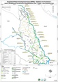
File:Infra rehab maps by polder 7apr 21.pdf (category Maps-polder) infra rehab by polder maps-polder(2,480 × 3,507 (9.52 MB)) - 04:52, 20 April 2021- Overview maps of the polders.11 members (0 subcategories, 11 files) - 09:58, 30 November 2021
- Polder maps from Blue Gold Program11 members (0 subcategories, 11 files) - 09:59, 30 November 2021

File:10jun 21 TerraSphere satellite mapping 2011 21.pdf (matches file content) 2011-2021 (3 maps for Khulna/Satkhira; 3 maps for Patuakhali) 5 maps for Perennial ghers: 2011, 2020 and change map 2011-2020 (3 maps for Khulna/Satkhira; 2(1,240 × 1,754 (909 KB)) - 07:01, 22 September 2021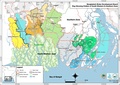
File:BWDB Circles, Divisions, BGP polders, Roads.pdf (category Maps-overview) BWDB Circles, Divisions, BGP polders, Roads maps-overview(2,481 × 1,754 (14.34 MB)) - 04:36, 20 April 2021
File:Satelligence final report 9jul 19.pdf (matches file content) kharif-I, kharif-II). Results are delivered as pixel maps and summarized statistics per polder. Maps are delivered per season for the baseline (20112015)(1,275 × 1,650 (5.2 MB)) - 10:12, 1 July 2020
File:O&M Guideline v5 5jan 18.pdf (matches file content) Bangla of the produced maps: Land Usage Maps (cropping pattern), Water Management Issue Maps and the Preferred Water Level Maps. All maps need to be digitalized(1,240 × 1,754 (6.6 MB)) - 16:24, 10 December 2020
File:BGIF03 IMARES WUR Quickscan Freswater Pearl Culture Feasibility 21jan 15.pdf (matches file content) study: gather as much information possible on Blue Gold polders in Patuakhali (maps, land use, environmental conditions), prepare questionnaires aimed at exploring(1,240 × 1,754 (569 KB)) - 10:58, 22 July 2020
File:E-3.6 CAWM Planning Workshop Khulna May 15-16 2019.pdf (matches file content) the collected data, identify the solutions, and prepared infrastructural maps and action plans. This process found more effective and cost-effective. 4(1,240 × 1,754 (613 KB)) - 18:51, 20 April 2021
File:E-3.1 CAWM Planning Workshop Pat 12-13 May 2018.pdf (matches file content) workshop, collecting data participants drew map and listed problems related to water management. Then prepared maps and problems were presented by the group(1,275 × 1,650 (516 KB)) - 18:19, 20 April 2021
File:BGIF08 Acacia - Feasibility study Aquifer Recharge for Agriculture 25feb 15.pdf (matches file content) Acacia Water Dhaka University 5 IWM has provided an altitude map of the Polder 22. This maps is shown in Figure 4. It shows that there is a difference in(1,240 × 1,754 (1.6 MB)) - 10:57, 22 July 2020
File:D-7 Training on Market Orientation for DAE FFS Facilitators.pdf (matches file content) process for performing the group activities. Each group made three value chain maps through their knowledge and understanding. After that, group leaders presented(1,240 × 1,753 (883 KB)) - 10:01, 20 April 2021
File:E-4.4 CAWM Robi Planning Workshop Pat+Khu Oct 22&29 2019.pdf (matches file content) Amulendu & Shusanta Presentation Amalendu Biswas Group work with help of maps Atik, Amulendu Presentation, Small Group Work Atik & Shusanta Presentation;(1,275 × 1,650 (830 KB)) - 18:56, 20 April 2021
File:G-3.1 UP workshop on Validation Catchment WM Plan Khulna.pdf (matches file content) has taken 3 to 4 hours of time. In this session WMG drown their own area maps in the brown paper, analyzed crops & water management relations, identified(1,275 × 1,650 (887 KB)) - 05:50, 21 April 2021
File:E-1.4 CAWM Orientation Satkhira 23-24 Jul July 2017.pdf (matches file content) Presentation, Discussion Experience Sharing Small Group Discussion, VIPP Maps; presentation; Field visit Small Group Work Review the day learning Day(1,240 × 1,754 (1.02 MB)) - 17:53, 20 April 2021
File:TR14 Phase 1 Baseline Survey Report.pdf (matches file content) Google Maps. In ODK Aggregate exporting the data into a KML file is as simple as a point and click. Using the GPS data, Google Earth or Google Maps will(1,240 × 1,754 (4.44 MB)) - 04:15, 10 March 2021
File:E-3.2 CAWM Planning Workshop Pat May 12-13 2019.pdf (matches file content) Group Exercise & Model Preparation Atik, Sydur & Amol - Demonstration of maps with possible best solution Review and identify best solutions CAWM implementation(1,240 × 1,754 (967 KB)) - 18:29, 20 April 2021
File:WP08A participatory monitoring red 28feb 17.pdf (matches file content) shown�in�polder�maps�using�different�colours:�level�0�=�red,�level�1�=�orange,�level�2�=�yellow,�and�level�3� =�green.�Thus,�four�theme�wise�maps�have�been�(1,239 × 1,754 (5.98 MB)) - 04:46, 28 July 2020
File:ARM Aide Memoire 2-14oct 2016 31oct 16.pdf (matches file content) available the required information (expected land acquisition projected on mouza maps). (Recommendation 1.7). The release of funds by the EKN should be synchronized(1,239 × 1,754 (4.25 MB)) - 10:54, 22 July 2020
File:ARM Aide Memoire 25Nov-4Dec 2017 26feb 18.pdf (matches file content) layouts/alignments on mouza maps for a potential seventeen works that involve land acquisition and submit draft acquisition maps to the BWDB Field XEN. However(1,240 × 1,754 (1.43 MB)) - 10:54, 22 July 2020
File:TM Field Manual BGP PWM Eng 1feb 17.pdf (matches file content) d ‐representatives as follows: o Prepare validated polder and catchment maps (big size) showing data gathered during the WLUA meeting. If needed,(1,239 × 1,754 (292 KB)) - 09:58, 2 July 2020
File:MoU DoF 25nov 14.pdf (matches file content) headquarters and at zonal offices in respect of exchanging information, data, maps, documentation etc. required to make Blue Gold Program participatory and(1,272 × 1,754 (3.18 MB)) - 09:48, 12 July 2020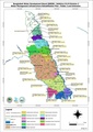
File:Catchment maps at polder level 7apr 21.pdf (category Maps-polder) Catchment maps maps-polder(1,753 × 2,480 (22.99 MB)) - 04:54, 20 April 2021
File:Upazila union on 4 overview maps 7apr 21.pdf (category Maps-overview) BGP upazilas unions on 4 overview maps maps-overview(1,753 × 2,480 (1.11 MB)) - 04:31, 20 April 2021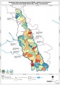
File:CAHW polder maps 4apr 21.pdf (category Maps-polder) CAHW - Community Animal Health Workers maps-polder(1,753 × 2,480 (6.1 MB)) - 04:43, 20 April 2021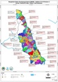
File:FT polder maps 4apr 21.pdf (category Maps-polder) FTs by polder maps-polder(1,753 × 2,480 (6.18 MB)) - 04:44, 20 April 2021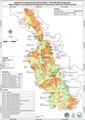
File:FFS polder maps 7apr 21.pdf (category Maps-polder) FFS - Farmer Field Schools maps-polder(1,753 × 2,480 (8.5 MB)) - 04:50, 20 April 2021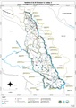
File:Market growth centre polder maps 4apr 21.pdf (category Maps-polder) market growth centre locations maps-polder(2,480 × 3,507 (8.86 MB)) - 04:51, 20 April 2021
File:TR05 Inventory Geoinformation Dec2013.pdf (matches file content) digitize the village maps. The current maps are drawn without real dimensions and points to geo-reference the maps. With a basic map from a GIS system, more(1,240 × 1,754 (1.29 MB)) - 02:08, 12 July 2020
File:D-5 Training on Market Orientated FFS (10 days).pdf (matches file content) decision taken from review meting, 1. The social map will prepare by community people, earlier the social maps were prepared by the respective PFs. 2. Checklist(1,275 × 1,650 (2.36 MB)) - 10:00, 20 April 2021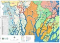
File:FT overview 4apr 21.pdf (category Maps-overview) FT overview maps-overview(2,480 × 1,753 (546 KB)) - 04:26, 20 April 2021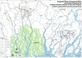
File:CII overview 7apr 21.pdf (category Maps-overview) CII - Cropping Intensity Initiative maps-overview(1,753 × 1,240 (263 KB)) - 04:21, 20 April 2021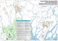
File:BGIF overview 7apr 21.pdf (category Maps-overview) BGIF - Blue Gold Innovation Fund maps-overview(4,966 × 3,507 (2.3 MB)) - 04:33, 20 April 2021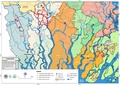
File:CAHW overview 4apr 21.pdf (category Maps-overview) CAHW overview maps-overview(1,753 × 1,240 (2.78 MB)) - 04:37, 20 April 2021
File:SW overview 7apr 21.pdf (category Maps-overview) SW overview maps-overview(1,753 × 2,480 (540 KB)) - 04:24, 20 April 2021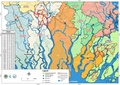
File:FFS overview map 7apr 21.pdf (category Maps-overview) FFS overview maps-overview(2,480 × 1,753 (555 KB)) - 04:30, 20 April 2021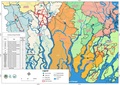
File:Input provider overview 7apr 21.pdf (category Maps-overview) Input providers overview maps-overview(2,480 × 1,753 (551 KB)) - 04:20, 20 April 2021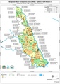
File:Resource farmers by polder 7apr 21.pdf (category Maps-polder) resource farmers by polders maps-polder(1,753 × 2,480 (7.27 MB)) - 04:46, 20 April 2021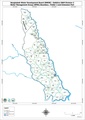
File:WMGs at polder level 6apr 21.pdf (category Maps-polder) WMGs at polder level maps-polder(2,480 × 3,507 (6.28 MB)) - 04:45, 20 April 2021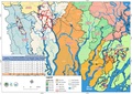
File:CAWM schemes overview DRAFT 13apr 21.pdf (category Maps-overview) CAWM overview maps - overview(2,480 × 1,753 (1.98 MB)) - 08:52, 11 May 2021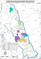
File:CAWM schemes by polder DRAFT 13apr 21.pdf (category Maps-polder) CAWM by polder maps - polder(2,480 × 3,507 (6.53 MB)) - 08:53, 11 May 2021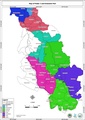
File:Unions mouzas at polder level 4apr 21.pdf (category Maps-polder) unions mouzas by polder maps-polder(1,753 × 2,480 (3.58 MB)) - 04:40, 20 April 2021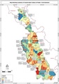
File:Input providers at polder level 7apr 21.pdf (category Maps-polder) Input providers by polder maps-polder(1,753 × 2,480 (4.71 MB)) - 04:42, 20 April 2021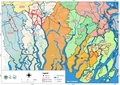
File:BGP overview polders districts upazilas roads 7apr 21.pdf (category Maps-overview) BGP overview polders districts upazilas roads maps-overivew(2,480 × 1,753 (551 KB)) - 04:28, 20 April 2021
File:27feb 21 WMO unified development of WMOs.pdf (matches file content) and came in a consensus with the villagers. Through the process village maps and boundary has been prepared on the basis of hydrological units. 5.2.(1,240 × 1,754 (658 KB)) - 05:46, 9 March 2021
File:TN 03 Benchmark Report on Mung Bean Patu MFS-final.pdf (matches file content) Benchmark Survey Report: Mung Bean-MFS Annex 1. Polder Maps (43/2D & 43/2F) Figure 6: Map of Polder 43/2D showing MFS Locations Technical Note 03(1,240 × 1,754 (1.19 MB)) - 04:46, 28 July 2020
File:PP TA ARM position paper 2017 18nov 17.pdf (matches file content) layouts/alignments on mouza maps for a potential seventeen works that involve land acquisition and submit draft acquisition maps to the BWDB Field XEN. However(1,240 × 1,754 (9.32 MB)) - 09:45, 2 July 2020
File:A1-1 Community Organization & Cooperatives Aug 25-30 2013.pdf (matches file content) programs (e.g. FFS) that were implemented Preparation of village and polder maps: delineation of WMG and WMA boundaries. In the case of IPSWAM polders, data(1,275 × 1,650 (1.25 MB)) - 07:28, 18 March 2021
File:P29 FRERMIP visit 13 March2017 v3 11apr 17.pdf (matches file content) the flow as possible. The cross-sectional survey provides: a. Bathymetric maps depicting the underwater landscape b. Cross sections along the banks to assess(1,239 × 1,754 (1,005 KB)) - 12:42, 8 July 2020
File:DEM-Khulna 22 CEGIS-(Nov-2016).pdf (matches file content) captured from these maps. The features were identified considering size, shape, pattern, texture and description available in the map. 2.6.3 Data editing(1,277 × 1,822 (1.41 MB)) - 09:00, 2 July 2020
File:PDP P25 22mar 17.pdf (matches file content) managed by the GIS specialist and used to generate specific geoinformation maps or figures, which are published on an open source website (Lizard Portal)(1,240 × 1,754 (1.16 MB)) - 10:48, 22 July 2020
File:AWP 2017 18 BGPAnnualPlan20172018.pdf (matches file content) that news. We have made catchment wise map, waterlogging maps, cropping pattern maps, Khals maps, WMG boundary maps and collectively moringa selling (one(1,240 × 1,754 (6.78 MB)) - 10:53, 22 July 2020
File:IR Inception Report, revised March 2014.pdf (matches file content) implemented, existing WMOs/CBOs and other data; Preparation of village and polder maps; Project information dissemination on Blue Gold Program: Goals, Objectives(1,275 × 1,650 (4.35 MB)) - 10:48, 22 July 2020
File:EIA P27 jan 20.pdf (matches file content) been utilized for hydrodynamic analysis. Available topography, soil maps, land use maps, weather 16 data, river network, cross-section, water level, discharge(1,240 × 1,754 (8.04 MB)) - 20:12, 9 December 2020
File:EIA P43 2B CEGIS Apr 16.pdf (matches file content) List of Maps Map 1.1: Base Map of Polder 43/2B .................................................................. 5 Map 4.1: Proposed Intervention Map of Polder(1,240 × 1,754 (14.46 MB)) - 10:49, 22 July 2020
File:ARM Aide Memoire 27Sep-13Oct 2015.pdf (matches file content) rabi cultivation and preparation of digital elevation maps, leading to a better understanding of the micro-‐level(1,240 × 1,753 (6.1 MB)) - 06:55, 15 April 2020
File:DEM-Patuakhali 43-1A-&-43-2F-CEGIS-(Nov-2016).pdf (matches file content) captured from these maps. The features were identified considering size, shape, pattern, texture and description available in the map. 2.6.3 Data editing(1,273 × 1,821 (3.63 MB)) - 08:57, 2 July 2020
File:EIA P28-1 jan 20.pdf (matches file content) List of Maps Map 1.1 :Blue Gold Program Area .................................................................................. 2 Map 1.2 :Map of Polder(1,240 × 1,754 (8.95 MB)) - 20:15, 9 December 2020
File:DEM Patuakhali 55-2A-&-55-2C-CEGIS-(Nov-2015).pdf (matches file content) captured from these maps. The features have been identified considering size, shape, pattern, texture and description available in the map. 2.4.3 Data editing(1,275 × 1,650 (2.01 MB)) - 08:40, 2 July 2020
File:GoN Program Document BGP 28Aug12.pdf (matches file content) can be made which is different from the green coloured polders in this Map. Map 1: Overview of the status of polders and their on-going programmes 26(1,239 × 1,754 (3.77 MB)) - 19:23, 8 July 2020
File:EIA Report Polder 25 aug 20.pdf (matches file content) salinity intrusion and highest flood level. Available topography, soil maps, land use maps, weather data, river network, cross-section, water level, discharge(1,240 × 1,754 (10.03 MB)) - 20:23, 9 December 2020
File:DEM-Khulna 29-&-30-CEGIS-(Jun-2017).pdf (matches file content) polder 29 and polder 30 is unavailable. Besides, BWDB topographic maps (Irrigation Map) in these areas are also unavailable at BWDB office. Figure 2.2 shows(1,250 × 1,889 (4.8 MB)) - 09:08, 2 July 2020
File:EIA P31 part CEGIS Jun 16.pdf (matches file content) 115 List of Maps Map 1.1: Base map of Polder 31 part ............................................................................ 5 Map 4.1: Location(1,240 × 1,754 (33.56 MB)) - 10:48, 22 July 2020
File:EIA P26 CEGIS Jun 16.pdf (matches file content) 118 xv List of Maps Map 1.1: Base map of Polder 26 ............................................................................. 5 Map 4.1: Location of(1,240 × 1,754 (51.83 MB)) - 09:54, 30 June 2020
File:EIA P34-2 jan 20.pdf (matches file content) All data used in the model calibration (including topography, soil maps, land use maps, and weather data, river network and cross-section, water level, discharge(1,240 × 1,754 (9.2 MB)) - 20:20, 9 December 2020
File:BGIF02 Deltares - Feasibility pump drainage system BG Polders Dec2014.pdf (matches file content) December 2014, final Google earth map of site visit area in Polder 2, with locations 1 (approx.), 2 and 3 (exact). This maps shows the small bunds dividing(1,275 × 1,650 (5.27 MB)) - 10:58, 22 July 2020
File:BGIF20 WorldFish - Ecopond and Empowerment Project II 8jan 18.pdf (matches file content) the selection of the women with small ponds necessary information about the maps of the polders, the list of the Water Management Groups (WMGs) located within(1,275 × 1,650 (2.19 MB)) - 10:57, 22 July 2020
File:DEM-Patuakhali-47-3-&-47-4-CEGIS-(Jan-2018).pdf (matches file content) captured from these maps. The features were identified considering size, shape, pattern, texture and description available in the map. 2.4.3 Data editing(1,250 × 1,793 (11.96 MB)) - 08:50, 2 July 2020
File:EXT Agro-Insight report v13 3may 18.pdf (matches file content) Members of the catchment committee make a map of their area with the staff Coordination meetings Making maps of sluice catchment areas Reach For each(1,240 × 1,754 (2.15 MB)) - 10:49, 22 July 2020
File:EIA P43 2D CEGIS Jun 15.pdf (matches file content) All data used in the model calibration (including topography, soil maps, land use maps, and weather data, river network and cross-section, water level, discharge(1,240 × 1,753 (16.63 MB)) - 10:49, 22 July 2020
File:EIA P29 CEGIS Jun 16.pdf (matches file content) xvi List of Maps Map 1.1: Base map of Polder 29 .................................................................................... 5 Map 4.1: Location(1,240 × 1,754 (20.54 MB)) - 11:20, 1 July 2020
File:EIA P43 2F CEGIS Jun 15.pdf (matches file content) . 116 List of Maps Map 1.1: Base map of Polder 43/2F .................................................................. 3 Map 4.1: Map showing proposed(1,240 × 1,754 (15.27 MB)) - 10:49, 22 July 2020
File:EIA P30 CEGIS Sep 15.pdf (matches file content) List of Maps Map 1.1: Base Map of the Polder 30 .................................................................................... 3 Map 4.1: Proposed(1,240 × 1,754 (14.5 MB)) - 10:49, 22 July 2020
File:EIA P43 2A CEGIS Jun 15.pdf (matches file content) List of Maps Map 1.1: Base map of Polder43/2A................................................................... 5 Map 4.1: Proposed Intervention Map of Polder(1,240 × 1,754 (15.37 MB)) - 10:48, 22 July 2020
File:EIA P2 CEGIS Jun 16.pdf (matches file content) 122 xv List of Maps Map 1.1: Base map of Polder 2 ........................................................................ 5 Map 4.1: Location of the(1,240 × 1,754 (9.51 MB)) - 10:53, 22 July 2020
File:EIA P43 2E CEGIS Apr 16.pdf (matches file content) 114 xv List of Maps Map 1.1: Base map of Polder43/2E ................................................................... 5 Map 4.1: Location ofproposed(1,240 × 1,754 (9.99 MB)) - 10:49, 22 July 2020
File:DEM Patuakhali 43-2A,-43-2B,-43-2D-&-43-2E-CEGIS-(Nov-2016).pdf (matches file content) captured from these maps. The features were identified considering size, shape, pattern, texture and description available in the map. 2.6.3 Data editing(1,273 × 1,822 (5.55 MB)) - 08:54, 2 July 2020
File:BGIF32 29nov 20 Final Report BGIF-KU WH project.pdf (matches file content) of Statistics, World Bank and World Food Program (WFP). Bangladesh Poverty Maps, 2014. 13 WFP, 2012. Indicators based on the 2012 Bangladesh Child and(1,240 × 1,754 (1.61 MB)) - 19:52, 9 December 2020
File:EIA P28-2 jan 20.pdf (matches file content) of Maps Map 1.1 Blue Gold Program Area Map 1.2 Base map of Polder 28/2 in Batiaghata Upazila under Khulna District vii 3 4 Map Map Map Map Map Map(1,240 × 1,754 (8.64 MB)) - 20:16, 9 December 2020
File:EIA P43 1A CEGIS Apr 16.pdf (matches file content) .. 179 List of Maps Map 1.1: Base map of Polder 43/1A......................................................................... 4 Map 4.1: Proposed Intervention(1,240 × 1,754 (12.93 MB)) - 10:49, 22 July 2020
File:EIA P22 CEGIS Sep 15.pdf (matches file content) 184 xi List of Maps Map 1.1: Map Showing the Study Area ................................................................... 5 Map 4.1: Location of Proposed(1,240 × 1,754 (12.37 MB)) - 10:49, 22 July 2020
File:BGIF01 IWM - Planning design and monitoring of community based WM systems in P30 .Jan2014.pdf (matches file content) inundation map under improvement option-2 ................................ 19 Figure 16: Map showing the GPS alignment data with the mouza map. ........(1,240 × 1,754 (5.15 MB)) - 10:58, 22 July 2020
File:BGIF33 17aug 20 FINAL PROJECT REPORT BG CAMASMA CIMMYT BD.pdf (matches file content) of this project. Objective 1 studies farmer decision making processes and maps social networks to better understand climate- and market-smart advisory demand(1,275 × 1,650 (2.06 MB)) - 19:54, 9 December 2020
File:BGIF04 Groenemeijer WUR - Baseline P30 Community Water Management Pilot 28feb 15.pdf (matches file content) cannot be mapped. Farmers have a sense of the location of their fields but cannot point it out on a Google Earth map or even the landholdings map. Secondly(1,240 × 1,754 (6.13 MB)) - 07:05, 12 July 2020
File:TR07 Field Trip Reports 2013 15apr 14.pdf (matches file content) establishments, land types and land use in maps. Use of the same set of legends/symbols in all village maps will make the maps easily understandable and comparable(1,275 × 1,650 (2.21 MB)) - 10:37, 22 July 2020
File:PP TA ARM position paper 2018 3nov 18.pdf (matches file content) area maps of polders Project area showing locations of three batches of phasing-out polders District and upazila boundaries overlaid on polder maps BWDB(1,240 × 1,754 (31.43 MB)) - 09:52, 2 July 2020
File:DEM Khulna 2, 26 & 31part IWM (Jul 2015).pdf (matches file content) culverts) Internal khals alignment Road alignment. Maps (Land elevation, catchment layout and Hydrological map showing khals, hydraulic structures and road network)(1,240 × 1,754 (3.48 MB)) - 10:57, 1 July 2020
File:MF P26 master file 30sep 15.pdf (matches file content) planning study report, project documents, annual plan of operation, polder area maps analysis and project progress report were kept and analysis in order to gathered(1,240 × 1,754 (2.1 MB)) - 13:25, 20 April 2021
File:TR09 WMOs Comparative Analysis 28apr 14.pdf (matches file content) of land acquisition. Approval of baseline data by WMIP-PCU. Finalize the maps prepared by under cycle -1, Selection Criteria for SIMT and OMIP. Apply Screening(1,240 × 1,754 (741 KB)) - 10:59, 22 July 2020
File:EIA Report Polder 55 2C aug 20.pdf (matches file content) All data used in the model calibration (including topography, soil maps, land use maps, and weather data, river network and cross-section, water level, discharge(1,240 × 1,754 (8.87 MB)) - 20:29, 9 December 2020
File:EIA P55 2A jan 20.pdf (matches file content) All data used in the model calibration (including topography, soil maps, land use maps, and weather data, river network and cross-section, water level, discharge(1,240 × 1,754 (6.86 MB)) - 20:21, 9 December 2020
File:EIA Report Polder 47-4 aug 20.pdf (matches file content) List of Maps Map 1.1 Blue Gold Program Area ......................................................................................... 2 Map 1.2: Map of Polder(1,240 × 1,754 (7.75 MB)) - 20:27, 9 December 2020
File:EIA Report Polder 47 3 aug 20.pdf (matches file content) All data used in the model calibration (including topography, soil maps, land use maps, and weather data, river network and cross-section, water level, discharge(1,240 × 1,754 (7.4 MB)) - 20:26, 9 December 2020
File:BGIF15 Just Farming - Increasing Quality in Mungbean Production 23oct 17.pdf (matches file content) the campaign as well as allow farmer locations to be spotted on the map in one view (see figure 2). Figure 2: Field locations Within Farmforce(1,239 × 1,754 (640 KB)) - 10:57, 22 July 2020
File:BGIF09 nhc FRERMIP - Final report Emergency protection works P29 23jun 18.pdf (matches file content) bank of the river. The development of the right bank line can be seen in the map in Figure 2.1-1, showing a gradual shift of the bank to the west in the upstream(1,240 × 1,754 (7.01 MB)) - 10:57, 22 July 2020
File:TR24 2018 2019 CAWM Strategic Plan 16sep 18.pdf (matches file content) in cropping pattern-, water management issues- and water level management maps and detailed water management action plans. See also “Operations and Maintenance(1,240 × 1,754 (1.1 MB)) - 02:06, 12 July 2020
File:B 1 may 15 LCS Training Report Khulna Satkhira.pdf (matches file content) interactive discussion. The training team used flip chart, PVC polder and sectional maps, whiteboard, marker pens, VIPP card, handouts, masking tape during conducting(1,240 × 1,754 (1.19 MB)) - 05:16, 25 May 2021
File:26feb 21 WMO alt developing WMOs.pdf (matches file content) and came in a consensus with the villagers. Through the process village maps and boundary has been prepared on the basis of hydrological units. 5.2.(1,275 × 2,100 (661 KB)) - 10:03, 11 April 2021
File:GoB WARPO Bangladesh Water Act 2013 (English).pdf (matches file content) description of water resources with present geographical location and mouza map; (b) analysis of economic, natural, social, political, environmental, and(1,240 × 1,754 (432 KB)) - 05:48, 28 June 2020
File:P29 key messages to workshop with slides.pdf (matches file content) Patuakhali, Barguna, Khulna, Bagherat and Satkhira. SLIDES 5, 6 and 7 – Maps of Severe Erosion Damage 7. Of these 22 polders, our recent records show(1,240 × 1,754 (1.89 MB)) - 05:20, 10 March 2021
File:C-1.2 Curriculum Development Workshop Compilation report.pdf (matches file content) office. That map should be used as a starting point and can be updated if necessary. If no map is available, the FO will produce the map. The FOs will(1,240 × 1,754 (1.04 MB)) - 05:31, 20 April 2021
File:C-3.2 Development CPW Compilation of all curriculum.pdf (matches file content) office. That map should be used as a starting point and can be updated if necessary. If no map is available, the FO will produce the map. The FOs will(1,240 × 1,754 (1.04 MB)) - 05:37, 20 April 2021
File:P29 Lower Bhadra IWM river survey report 23jul 17.pdf (matches file content) projection system has been used for data collection as well as projection of Maps & Charts. This is to mention here that entire survey area is under UTM 45N(1,275 × 1,650 (8.99 MB)) - 19:46, 8 July 2020
File:BGIF26A United Purpose - Feasibility study SWIFT 17apr 18.pdf (matches file content) through Indigenous Finance and 3 List of Figures Figure 1: District map of Patuakhali district Figure 2: Polders 43/2A under Patuakhali District,(1,240 × 1,754 (2.36 MB)) - 10:57, 22 July 2020
File:PDP P28-2 15jun 17.pdf (matches file content) managed by the GIS specialist and used to generate specific geoinformation maps or figures, which are published on an open source website (Lizard Portal)(1,240 × 1,754 (2.14 MB)) - 10:48, 22 July 2020
File:PDP P27-1 22mar 17.pdf (matches file content) managed by the GIS specialist and used to generate specific geoinformation maps or figures, which are published on an open source website (Lizard Portal)(1,240 × 1,754 (1.17 MB)) - 10:48, 22 July 2020
File:PDP P47-3 27aug 17.pdf (matches file content) managed by the GIS specialist and used to generate specific geoinformation maps or figures, which are published on an open source website (Lizard Portal)(1,240 × 1,754 (2.11 MB)) - 10:40, 22 July 2020
File:PDP P27-2 15jun 17.pdf (matches file content) managed by the GIS specialist and used to generate specific geoinformation maps or figures, which are published on an open source website (Lizard Portal)(1,240 × 1,754 (1.93 MB)) - 10:48, 22 July 2020
File:PDP P28-1 22mar 17.pdf (matches file content) managed by the GIS specialist and used to generate specific geoinformation maps or figures, which are published on an open source website (Lizard Portal)(1,240 × 1,754 (1.16 MB)) - 10:48, 22 July 2020
File:C-5 Orientation cum ToT on Homestead Poultry, Nutrition Module.pdf (matches file content) resource map. A dummy transect walk was done through the resource center by four groups. Then four groups came together, draw a resource map and present(1,275 × 1,650 (568 KB)) - 05:40, 20 April 2021
File:BGIF12 MetaMeta - Roads for Water Management and Flood Protection Nov2017.pdf (matches file content) functional, and 3 had low capacity according to local respondents (Figure 5). The map below (Figure 6) locates functional and non-functional culverts and bridges(1,753 × 1,240 (24.68 MB)) - 10:57, 22 July 2020
File:F-3 Foundation Training Participatory Water Mgmt May 2-8 2017.pdf (matches file content) Discussion with PPP PCD-BWDB DTL-BGP LGD with PPP, Map Demonstration VDO Demonstration PCD-BWDB LGD with PPP, Map Demonstration PD-(DAE part) or DAE-Rep. Homework:(1,240 × 1,754 (1.27 MB)) - 19:09, 20 April 2021
File:E-1.3 CAWM Orientation Khulna 18-19 Sep 2017.pdf (matches file content) opportunity etc. Indicate in map local institution UP, school, club, market, road, embankment etc. Total geographical status cite in map, land topography, cropping(1,240 × 1,754 (1.54 MB)) - 17:51, 20 April 2021
File:TR16A Field Trip Reports from 2014 5may 15.pdf (matches file content) and village mapping activities. Polder 26 covers 12 villages. Six village maps have been completed while 2,194 households have been surveyed out of 4,200(1,240 × 1,754 (3.05 MB)) - 10:37, 22 July 2020
File:WP02A Exit Strategy feb 16 v2.pdf (matches file content) easy-to-understand flowchart of main activities per WMG and / or WMA; Develop maps (existing cropping patterns, land elevation classes, potential cropping patterns)(1,239 × 1,754 (562 KB)) - 03:59, 24 November 2020
File:TR 08 Operational Manual for Output and Outcome Monitoring.pdf (matches file content) The results are presented using colour maps of polders for a Water Management Group village. The resulting maps give a quick and easily understood overview(1,240 × 1,754 (1.25 MB)) - 10:37, 22 July 2020
File:PDP P34-2part 20aug 17.pdf (matches file content) managed by the GIS specialist and used to generate specific geoinformation maps or figures, which are published on an open source website (Lizard Portal)(1,240 × 1,754 (2.48 MB)) - 10:48, 22 July 2020
File:PDP P31part 5feb 17.pdf (matches file content) managed by the GIS specialist and used to generate specific geo4 information maps or figures, which are published on an open source website (Lizard Portal)(1,240 × 1,754 (2.02 MB)) - 10:48, 22 July 2020
File:PDP P55-2A 15jun 17.pdf (matches file content) managed by the GIS specialist and used to generate specific geoinformation maps or figures, which are published on an open source website (Lizard Portal)(1,240 × 1,754 (2.33 MB)) - 10:40, 22 July 2020
File:PDP P22 5feb 17.pdf (matches file content) managed by the GIS specialist and used to generate specific geo4 information maps or figures, which are published on an open source website (Lizard Portal)(1,240 × 1,754 (2.09 MB)) - 10:48, 22 July 2020
File:PDP P55-2C 15jun 17.pdf (matches file content) managed by the GIS specialist and used to generate specific geoinformation maps or figures, which are published on an open source website (Lizard Portal)(1,240 × 1,754 (2.61 MB)) - 10:40, 22 July 2020
File:PDP P47-4 27aug 17.pdf (matches file content) managed by the GIS specialist and used to generate specific geoinformation maps or figures, which are published on an open source website (Lizard Portal)(1,240 × 1,754 (2.57 MB)) - 10:40, 22 July 2020
File:PDP P43-2F 5feb 17.pdf (matches file content) managed by the GIS specialist and used to generate specific geo4 information maps or figures, which are published on an open source website (Lizard Portal)(1,240 × 1,754 (1.88 MB)) - 10:41, 22 July 2020
File:PDP P29 5feb 17.pdf (matches file content) managed by the GIS specialist and used to generate specific geo4 information maps or figures, which are published on an open source website (Lizard Portal)(1,240 × 1,754 (2.5 MB)) - 10:48, 22 July 2020
File:PDP P26 5feb 17.pdf (matches file content) managed by the GIS specialist and used to generate specific geo4 information maps or figures, which are published on an open source website (Lizard Portal)(1,240 × 1,754 (2.12 MB)) - 10:48, 22 July 2020
File:PDP P43-1A 5feb 17.pdf (matches file content) managed by the GIS specialist and used to generate specific geo4 information maps or figures, which are published on an open source website (Lizard Portal)(1,240 × 1,754 (2.49 MB)) - 10:48, 22 July 2020
File:PDP P30 5feb 17.pdf (matches file content) managed by the GIS specialist and used to generate specific geo4 information maps or figures, which are published on an open source website (Lizard Portal)(1,240 × 1,754 (2.4 MB)) - 10:48, 22 July 2020
File:EIA P27 BWDB Sep 19.pdf (matches file content) been utilized for hydrodynamic analysis. Available topography, soil maps, land use maps, weather data, river network, cross-section, water level, discharge(1,240 × 1,754 (7.81 MB)) - 10:19, 30 June 2020
File:BGIF06 Greyshack - Feasibility study on renewable energy Dec2015.pdf (matches file content) ��������������������������������������������������������������� 6 1.4 Road map of the report�������������������������������������������������������������������(1,275 × 1,650 (7.82 MB)) - 10:57, 22 July 2020
File:Feb 15 CAWM P30 baseline pilot martina groenemeijer feb 15.pdf (matches file content) cannot be mapped. Farmers have a sense of the location of their fields but cannot point it out on a Google Earth map or even the landholdings map. Secondly(1,240 × 1,754 (6.08 MB)) - 13:49, 20 April 2021
File:PDP P43-2D 5feb 17.pdf (matches file content) managed by the GIS specialist and used to generate specific geo4 information maps or figures, which are published on an open source website (Lizard Portal)(1,240 × 1,754 (3.22 MB)) - 10:48, 22 July 2020
File:PDP P43-2B 5feb 17.pdf (matches file content) managed by the GIS specialist and used to generate specific geo4 information maps or figures, which are published on an open source website (Lizard Portal)(1,240 × 1,754 (2.56 MB)) - 10:48, 22 July 2020
File:PDP P43-2E 5feb 17.pdf (matches file content) managed by the GIS specialist and used to generate specific geo3 information maps or figures, which are published on an open source website (Lizard Portal)(1,240 × 1,754 (2.32 MB)) - 10:41, 22 July 2020
File:PDP P43-2A 5feb 17.pdf (matches file content) managed by the GIS specialist and used to generate specific geo4 information maps or figures, which are published on an open source website (Lizard Portal)(1,240 × 1,754 (2.67 MB)) - 10:48, 22 July 2020
File:P29 IWM Lower Bhadra Survey Report 3rd Cycle nov 17.pdf (matches file content) projection system has been used for data collection as well as projection of Maps & Charts. This is to mention here that entire survey area is under UTM 45N(1,240 × 1,754 (14.29 MB)) - 19:52, 8 July 2020
File:EIA P28 1 BWDB Sep 19.pdf (matches file content) 78 List of Maps Map 1.1 Map of Polder 28/1 ............................................................................................ 3 Map 4.1 Location(1,240 × 1,754 (7.9 MB)) - 10:49, 22 July 2020
File:P29 Deltares Erik Mosselmann P29 Review of IWM study 8jan 16.pdf (matches file content) Chandgar and Baroaria are missing in the study area map of Figure 2.1. They are also not found in the maps in Figures 3.1, 4.1, 5.1 and 5.2. The first time(1,240 × 1,753 (683 KB)) - 06:03, 28 June 2020
File:BGIF19 Practical Action - Floating Cage Aquageoponics 8dec 17.pdf (matches file content) Canal selection discussion under polder 2……………………………….... 9 Figure 3: Map of polder 2 ……………………………………………………………. 10 Figure 4: Aquageoponics adapted(1,240 × 1,754 (2.26 MB)) - 10:57, 22 July 2020
File:E-3.3 CAWM Planning Workshop Satkhira Jul 4-5 2018.pdf (matches file content) Preparation of Action Plan - - 16.30-17.00 11. Workshop closing - Group wise map preparation Presentation on Crop-water system analysis Analysis and identify(1,240 × 1,754 (413 KB)) - 18:31, 20 April 2021
File:E-3.4 CAWM Planning Workshop Khulna Jul 2-3 2018.pdf (matches file content) Preparation of Action Plan - - 16.30-17.00 11. Workshop closing - Group wise map preparation Presentation on Crop-water system analysis Analysis and identify(1,240 × 1,754 (425 KB)) - 18:39, 20 April 2021
File:E-3.5 CAWM Planning Workshop Pat Jul 29-30 2018.pdf (matches file content) Conduct Field Visit and data collection Group wise field problem analysis, map preparation & presentation Review the day learning Field Visit Amol, Jewel(1,240 × 1,754 (430 KB)) - 18:48, 20 April 2021
File:MF P22 master file 15jun 14.pdf (matches file content) Definition 2.1 Polders situation at a glance at Khulna 2.2 All Polder in one Map 2.3 Map of polder 22 3 Description of polder 22 3.1 Geographical location 3.2(1,240 × 1,754 (2.11 MB)) - 13:28, 20 April 2021
File:MF P43 2B master file 7jul 15.pdf (matches file content) land use maps, because polder 43/2B is located in three upazilas- Galachipa upazila, Patuakhali Sadar upazila and Amtali upazila. The said maps is shown(1,275 × 1,650 (3.47 MB)) - 13:40, 20 April 2021
File:BGP thematic brochure 11 BGIF lessons learnt v1 8jan 20.pdf (matches file content) participate at an earlier stage in that case. The planning should also have mapped uncertainties and gaps, and how to circumnavigate activities through that(1,240 × 1,753 (12.02 MB)) - 15:53, 14 November 2021
File:EIA P34 2 BWDB Sep 19.pdf (matches file content) All data used in the model calibration (including topography, soil maps, land use maps, and weather data, river network and cross-section, water level, discharge(1,240 × 1,754 (7.54 MB)) - 10:49, 22 July 2020
File:BGIF QPR Apr-Jun 2016 2sep 16.pdf (matches file content) , including those with a low literacy level. Visualisation of results on maps, icons and stoplights is a key feature. BGP Innovation Fund: Apr‐Jun 2016(1,754 × 1,239 (234 KB)) - 09:53, 24 June 2020
File:F-4.1 Training for O&M Sub com Khulna Apr 22-26 2018.pdf (matches file content) whole day the participants were presented their group outcomes - the WMGs map, information of water management problems and solutions to potential crops(1,275 × 1,650 (829 KB)) - 19:11, 20 April 2021
File:PR Apr-Sep 2013 10dec 13.pdf (matches file content) Hydrological Maps and Polder Water Requirement Report 10.1 Preparation Hydrological map and polder water requirement report (C1 will provide polder map with village(1,240 × 1,754 (1.5 MB)) - 10:40, 22 July 2020
File:P29 FRERMIP Final report Emergency protection works P29 v5 23jun 18.pdf (matches file content) bank of the river. The development of the right bank line can be seen in the map in Figure 2.1-1, showing a gradual shift of the bank to the west in the upstream(1,240 × 1,754 (3.09 MB)) - 19:10, 8 July 2020
File:DFID Conceptual Framework on Agriculture.pdf (matches file content) h_and_Statistics/UNIDO_IDR_2013_main_report.pdf 23 E.g. IGC’s Enterprise maps which has surveyed a number of large firms in each sector and finds that(1,239 × 1,754 (2.51 MB)) - 05:30, 10 March 2021
File:MF P2 master file 29jul 15.pdf (matches file content) to the south side. Map-01: Map of Bangladesh costal Polders Master file Polder 2 Page 9 1st Draft Map-02: Satkhira District Map Table-01: General(1,240 × 1,754 (2.8 MB)) - 13:37, 20 April 2021
File:CAWM 29oct 20 gajendrapur final construction report.pdf (matches file content) catchment map and catchment plan for proper water management. They have identified high land, low land, and medium land on the catchment map. They have(1,275 × 1,650 (7.79 MB)) - 20:02, 9 December 2020
File:D-13 Strengthening Value Chain Strategic Workshop.pdf (matches file content) procurement committee 24. Support community meeting 25. Prepare resource map 26. Support in trial selection and trial farmer selection 27. Monitoring support(1,275 × 1,650 (263 KB)) - 10:36, 20 April 2021
File:DEM Khulna 25, 27-1, 27-2, 28-1 & 28-2 CEGIS (Jan 2018).pdf (matches file content) Catchment area delineation and detail mapping. Drainage pattern/direction maps Technical Report 2 Introduction Figure 1.1: Study area of Polder(1,250 × 1,767 (15.88 MB)) - 09:05, 2 July 2020
File:MF P43 2D master file 20apr 15.pdf (matches file content) polder 2.1 About polder 2.2 Polders situation at a glance at Patuakhali 2.3 Maps of polders 43/2D 2.4 Description of polder 43/2D 2.5 Geographical location(1,240 × 1,754 (4.51 MB)) - 13:46, 20 April 2021
File:AWP 2015 Annual Plan 2015 v5 241214.pdf (matches file content) assessment already taking place 7.4 Village mapping stopped. Previous village maps used by GIS experts in identifying relevant information/data for digitizing(1,240 × 1,754 (6.3 MB)) - 10:53, 22 July 2020
File:TR 13 BlueGold WMG LGI cooperation Report 05.pdf (matches file content) to focus on the opportunities and potential of a delineated area. Resource maps are an important tool for these joint planning exercises. 4.3 Supporting(1,240 × 1,754 (1.17 MB)) - 03:58, 24 November 2020
File:BGIF27A Innovision - Feasibility Study Pangasius aquaculture 21may 18.pdf (matches file content) resources in the form of canal and low-intervened aquaculture zone. Fig. 1. Map showing the study areas of three Upazillas. 7|Page 3.2 Data Collection(1,275 × 1,650 (1,004 KB)) - 10:57, 22 July 2020
File:MF P43 2E master file 24jun 15.pdf (matches file content) part. South – East line is oblique with both Longitude and Latitude. Fig: Map of Polder 43/2E Surrounding area: North: Lohalia River South-East:(1,240 × 1,754 (2.37 MB)) - 13:29, 20 April 2021
File:EIA P28 2 BWDB Sep 19.pdf (matches file content) ............. 77 xi List of Maps Map 1.1 Base map of Polder 28/2 in Batiaghata Upazila under Khulna District 3 Map 4.1 Location of the proposed interventions(1,240 × 1,754 (7.01 MB)) - 10:53, 22 July 2020
File:MF P29 master file 4nov 14.pdf (matches file content) Polder 29 Page 13 3.4 Map of Bangladesh costal Polders Master file Polder 29 Page 14 Master file Polder 29 Page 15 Map of Polder 29 Master file(1,240 × 1,754 (3.97 MB)) - 13:43, 20 April 2021
File:18feb 21 BGIF booklet practical innovations in CZ v4.5.pdf (matches file content) participate at an earlier stage in that case. The planning should also have mapped uncertainties and gaps, and how to circumnavigate activities through that(1,240 × 1,753 (26.16 MB)) - 15:51, 14 November 2021
File:MF P43 1A master file 4aug 15.pdf (matches file content) Linkage between Rural Producers and Input Sellers Product wise market map/value chain map 38 39 39 40 40 41 42 42 42 43 44 44 45 45 46 47 47 48 48-50 50 51(1,275 × 1,650 (2.51 MB)) - 13:32, 20 April 2021
File:TR04 Introduction to ME manual 11dec 13.pdf (matches file content) The results are presented using colour maps of polders for a Water management Group village. The resulting maps give a quick and easily understood overview(1,240 × 1,754 (934 KB)) - 10:37, 22 July 2020
File:B-5.3 PDP Polder 22 April 23, 2014.pdf (matches file content) km Map in Figure 5 shows the existing water management infrastructures in polder 22. Euroconsult Mott MacDonald & Associates 28 Figure 5: Map of Polder(1,240 × 1,754 (3.51 MB)) - 10:57, 19 April 2021
File:P29 BWDB design drawings groynes 1nov 16.pdf (matches file content) RY BV: ~ : (,~~~UOtllDtJZZAMANI. ~11I1! "1'\ (1,·V. 11!\' •..• 1I'·. I MAP Di::SICNED OY: II MD, SIIOIJIOUUAMAN1, .I, BOARD ENGINEER t==>: ,(1,770 × 1,297 (4.69 MB)) - 19:34, 8 July 2020
File:TNR int5 Training Report AIWW water policy 6dec 15.pdf (matches file content) bjectives and products Prober water distribution and minimize water loses 9Road map 9Handbook rehabilitation & maintenance 9Masterplan for channel rehabilitation(1,239 × 1,754 (5.25 MB)) - 05:00, 6 May 2021
File:OT Hague Academy Multi-level Water Governance 26Oct-6Nov2015.pdf (matches file content) effective and efficient stakeholder engagement: 1. Inclusiveness and equity: Map all stakeholder who have a stake in the outcome or that are likely to be affected(1,240 × 1,754 (868 KB)) - 04:57, 6 May 2021
File:I-1 PMPR EWS training 1st 2nd batch Feb 7-8 & 19-20 2015.pdf (matches file content) Question & answer A bucket of Water, Multimedia Projector, Hand Out and Map of Bangladesh Roles to Risk Reduction Pre, during & post activities of cyclone(1,275 × 1,650 (869 KB)) - 19:30, 20 April 2021
File:MF P31-part master file 6apr 15.pdf (matches file content) data collection Polders situation at a glance at Khulna All Polder in one Map Map of polder 31part Description of polder 31 part Geographical location General(1,240 × 1,754 (5.12 MB)) - 13:47, 20 April 2021
File:WP5 - Theory of Change rev 2 25may 16.pdf (matches file content) partnerships (target 17.17). Capacity building of the BWDB to monitor and map the situation in the polders, for example through the use of GIS, is done(1,240 × 1,754 (3.13 MB)) - 03:56, 24 November 2020
File:C-1.1 Curriculum Dev. Workshop (30-10-2013).pdf (matches file content) Community Resource Mapping Through Transect Walk Situation Analysis and resource map after Transect Walk Situation analysis (Resource list, Present Practice of(1,275 × 1,650 (339 KB)) - 05:29, 20 April 2021
File:MF P43 2A master file 26apr 15.pdf (matches file content) and input sellers 10.7 10.8 30 30-31 Product wise market map/Value chain map Page 4 29 34-35 35-36 36-38 38 55 38 39 39 96 39 40 40 40(1,275 × 1,650 (2.51 MB)) - 13:35, 20 April 2021
File:WMG tracker mPower presentation 25oct 17.pdf (matches file content) 10 Web Application Web Application Participatory Monitoring Report: Geo Map View - WMG Performance Participatory Monitoring Report: WMG Performance Trend(1,754 × 1,240 (1.33 MB)) - 16:02, 20 April 2021
File:P29 Lower Bhadra IWM borehole investigation 23jul 17.pdf (matches file content) ltd.) Page 19 of 19 ANNEXURE ANNEX-A (Borehole Location Map) BOREHOLE LOCATION MAP Lower Bhadra River Batiaghata, Khulna E 749612 N 2509478 BH-01(1,275 × 1,650 (1.42 MB)) - 18:25, 8 July 2020
File:BGIF10 Nice Foundation - Improved Pig Hygiene in Kawra Community 13nov 16.pdf (matches file content) Kawra/pig-rearing community of Southwest Bangladesh’ 82 2 Figures Page 1 Map of Batiaghata 13 2 Sex characteristics of respondents 22 3 Age characteristics(1,240 × 1,754 (2.93 MB)) - 10:57, 22 July 2020
File:WP03 Building organisation 2jun 16.pdf (matches file content) by collecting secondary data on hydrology and agriculture and by preparing maps of the polder area; 2. Water and land use planning workshop – this is a one-day(1,239 × 1,754 (1.31 MB)) - 10:59, 22 July 2020
File:UN nov 15 Satkhira Waterlogging Meta-Review Report.pdf (matches file content) groundtruthed to allow waterlogged areas in the southwest and development of maps accurate within 20cataloguing of the land/ water use options 30 meters, in(1,275 × 1,650 (2.65 MB)) - 17:05, 10 December 2020
File:TR23 Phase II Socio-Economic Baseline Survey 31may 18.pdf (matches file content) 11-85 vi Blue Gold Program List of Figures Figure 1-1: Road network map of BGP polders ..........................................................(1,275 × 1,650 (5.24 MB)) - 10:37, 22 July 2020
File:F-1 Training on Water Management Org Apr 7-16 2014.pdf (matches file content) Steps and process Group Discussions People Involved Map Training course on Water Management Organizations, Apr 7-16, 2014 Shorab(1,240 × 1,753 (975 KB)) - 19:21, 20 April 2021
File:EIA P55 2A BWDB Sep 19.pdf (matches file content) List of Maps Map 1.1: Map of Polder 55/2A polder boundary and Unions ......................................................................... 3 Map 5.1:(1,240 × 1,754 (6.23 MB)) - 10:49, 22 July 2020
File:TR19 Mustard Value Chain Analysis 22feb 17.pdf (matches file content) value chain _______________________________________________ 7 Value Chain Map ____________________________________________________________ 0 End Market(1,240 × 1,754 (1.78 MB)) - 10:59, 22 July 2020
File:P29 IWM Final Report polder29 red 24may 16.pdf (matches file content) �����ʹͻǡ��� LIST OF FIGURES Figure 2-1: Study area map .........................................................................(1,239 × 1,754 (4.02 MB)) - 19:29, 8 July 2020
File:Map - Satkhira.jpg Polder map of Satkhira district(3,507 × 4,960 (808 KB)) - 03:28, 24 November 2020
File:Map - Khulna.jpg Polder map of Khulna district(3,507 × 4,960 (1.36 MB)) - 03:22, 24 November 2020
File:Map - Patuakhali South.jpg Polder map of Patuakhali South(4,960 × 3,507 (793 KB)) - 04:58, 23 November 2020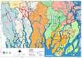
File:Overview map updated.jpg Overview map updated(4,960 × 3,507 (2.05 MB)) - 03:58, 25 November 2020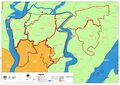
File:Map - Patuakhali North.jpg Polder map of Patuakhali North(4,960 × 3,507 (1.15 MB)) - 04:55, 23 November 2020
File:Overview Map.jpg (2,480 × 3,507 (420 KB)) - 06:14, 20 August 2020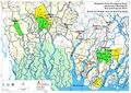
File:Bgp-sec-a-ch01-fig-map-01.jpg Map of Project Area(1,858 × 1,312 (902 KB)) - 06:28, 20 August 2020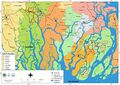
File:Blue gold program overview map.jpg Working areas of Blue Gold Program(4,960 × 3,507 (1.57 MB)) - 05:23, 22 November 2020
File:ARM Aide Memoire 9-20Nov 2018 11jan 19.pdf (matches file content) facilitate a large part of this process. The process results in resource maps and priority actions for O&M at the catchment level, including sluice command(1,240 × 1,754 (1.2 MB)) - 10:54, 22 July 2020
File:BGIF07 World Fish - Ecopond Project - Women-Headed Small Household Ponds 28Dec2015.pdf (matches file content) polder 30 in Botiaghata under Khulna District shown as ( asterisk) in the map of the polders 11 3 Fish production in small homestead ponds of women under(1,275 × 1,650 (4.3 MB)) - 10:57, 22 July 2020
File:Bgp-llr-printable-edition-20211219.pdf (matches file content) and Upazilas rather than by polder number. The maps below provide overlays of the Blue Gold polders on maps of Upazilas and Unions. Table 2.2 summarises(1,240 × 1,753 (20.78 MB)) - 06:04, 20 December 2021
File:WP7 Polder Growth & Business Development.KtJ 31aug 16.pdf (matches file content) Landless in Bangladesh 20 Appendix 3 Rural Transformation 21 Appendix 4 Map 22 Appendix 5 Value Chain 23 Tables No table of figures entries found(1,239 × 1,754 (1.39 MB)) - 19:45, 16 December 2020
File:P29 Breach- Background Note.pdf (matches file content) Chandghar is shown in Figure-1 (Mouza Map) comparing the alignment of the river bank at the time of surveying the Mouza map (unknown) and the sketched alignment(1,275 × 1,650 (1.08 MB)) - 12:45, 8 July 2020
File:MF P30 master file 15oct 14.pdf (matches file content) market linkage 87 4.4. Potential VC map: For Polder 30 Potential VC map are given below…… SESAME Value chain Map DAE Financial Institute BADC Private(1,240 × 1,754 (3.82 MB)) - 13:41, 20 April 2021
File:C-2 Curriculum Development Workshop on BGP for DAE.pdf (matches file content) adaptation techniques. Group Dynamics (e.g. “List as many as you can” or “Mental map exercise” ) Special topic (group exercise): Effect of organic matter on soil(1,240 × 1,754 (612 KB)) - 05:33, 20 April 2021
File:23jan 21 HYPR july december 2020.pdf (matches file content) submitted to the Director General of the Department of Livestock Services (DLS). Maps showing FFS interventions for each polder have been prepared. Despite challenges(1,240 × 1,754 (2.03 MB)) - 08:41, 11 May 2021
File:Appendix 7 BGIF project locations.png Appendix 7 Map of Blue Gold Innovation Fund project locations map(1,131 × 799 (1.06 MB)) - 05:02, 20 February 2020
File:TR18 Improved Water Management Pilot CWM P30 11jul 16.pdf (matches file content) 1: Overview Map of Polder 30 including location Fultala WMG ......................................................... 2 Figure 2: IWM Map showing an overview(1,240 × 1,754 (2.51 MB)) - 10:59, 22 July 2020
File:TR19 Improved Water Management - CWM Pilot P30 22sep 16.pdf (matches file content) 1: Overview Map of Polder 30 including location Fultala WMG .......................................................... 2 Figure 2: IWM Map showing an overview(1,239 × 1,754 (2.13 MB)) - 08:44, 11 May 2021
File:BGIF18 Consiglieri - Renewable Energy-Based Solutions 8aug 16.pdf (matches file content) 5: SWOT analysis of CSPS List of Figures Figure 1.1.1: Blue Gold Polder map Figure 1.3.1: Analytical steps of Methodology Figure 1.3.1.1: Steps in Technology(1,275 × 1,650 (2.37 MB)) - 10:57, 22 July 2020
File:Gender 11mar 14 gender approach based on inception report.pdf (matches file content) decrease of expenditure on food. 4.3 When conducting preparatory studies to map the current business situation and identify value chains to be further analyzed(1,754 × 2,480 (935 KB)) - 20:42, 9 December 2020
File:Riverbank protection oberhagemann 27oct 20.pdf (matches file content) Note: MDPI stays neutral with regard to jurisdictional claims in published maps and institutional affiliations. © 2020 by the authors. Licensee MDPI, Basel(1,240 × 1,753 (6.9 MB)) - 08:48, 11 May 2021
File:MF P43 2F 27sep 18.pdf (matches file content) the inter district road towards Barguna. Page 8 of 119 Map of Polder 43/2F Upazila & Union Map of Polder 43/2F Page 9 of 119 Before constructing polder(1,240 × 1,754 (3.37 MB)) - 13:38, 20 April 2021
File:BGIF16 Aspire-Insectsforall - Fish Feed using Insect Larvae 1nov 17.pdf (matches file content) 2.2 Climate Profiles of BG Target Areas The map below presents with the three BC Program regions (The map has been taken from the BG Innovation Fund web(1,239 × 1,754 (902 KB)) - 10:57, 22 July 2020
File:D-4 TOT for Producer Group Facilitators on MFS.pdf (matches file content) short value chain. He draw some example for agriculture product value chain map and show how vale added in different chain and why price is differ from farm(1,240 × 1,753 (3.9 MB)) - 09:48, 20 April 2021
File:TR06 Household Survey Report P22 30 43 2D 43 2F 31mar 14.pdf (matches file content) 22 and 30 are located in Khulna District as shown in Figure 1. The Polder maps at the right side show the villages included in the household survey. Figure(1,275 × 1,650 (4.02 MB)) - 02:32, 12 July 2020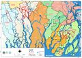
File:Overview.jpg Blue Gold overview map (updated)(4,960 × 3,507 (2.02 MB)) - 06:56, 24 November 2020- Error creating thumbnail: File with dimensions greater than 12.5 MP
File:BGP district upazila opt 3oct 18.png Polder map of Blue Gold Program.(6,622 × 4,677 (8.08 MB)) - 05:05, 22 November 2020 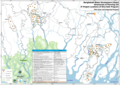
File:Appendix 8 BGIF project locations pilot and integrated.png Appendix 8 map of BGIF pilot and integrated project locations(1,187 × 839 (1.15 MB)) - 05:06, 20 February 2020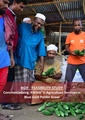
File:BGIF25 ProPortion& GrameenIntel - Commercialising Agricultural Extension Services Feb2018.pdf (matches file content) ‘KRISHE’ E-Agriculture service. The research team recommends a tentative road map to launch a controlled commercial pilot for the proposed concept of ‘KRISHE’:(1,239 × 1,754 (3.22 MB)) - 10:57, 22 July 2020
File:PR Jul-Sep 2014 19nov 14.pdf (matches file content) and analysis. 2014 9.4 Preparation of administrative and infrastructure maps Polders 22, 29, 30, 43/2A & 43/2F August-Sept 2014 Done 9.5 Attended(1,240 × 1,754 (1.75 MB)) - 10:40, 22 July 2020
File:BGIF05 CDI WUR - Opportunities for development of the Moringa sector Jul2015.pdf (matches file content) Moringa value chain is given below. Report CDI-15-102 | 37 Figure 9 Market Map of the Current Value Chain (and Future Opportunities) 5.4 Preliminary conclusions(1,240 × 1,753 (1.54 MB)) - 10:58, 22 July 2020
File:GoB National Agricultural Extension Policy (NAEP) 2012.pdf (matches file content) Appendix I Map of Bangladesh showing Agro-ecological Zones, ecologically constrained areas, poverty and nutritional status. 14 Appendix II Map of Bangladesh(1,275 × 1,722 (3.04 MB)) - 16:16, 10 December 2020
File:TR01 Proceedings Inception Report Workshop on 26 Jun 2013.pdf (matches file content) background of Blue Gold Program in short. He termed the inception report as a Road Map for the project. Mr. Md.Azizul Haque, Director General, BWDB was present in(1,275 × 1,650 (197 KB)) - 10:37, 22 July 2020
File:BGIF Procedures Manual v8 22may 18.pdf (matches file content) the southwest of Bangladesh: Patuakhali, Khulna, Barguna and Satkhira (see map in Figure 2.1). The Program covers 119,000 ha where more than 200,000 households(1,240 × 1,754 (2.41 MB)) - 09:44, 24 June 2020
File:PR jan jun 2018 HYPR Jan-June 2018 26jul 18.pdf (matches file content) topographic surveys have been completed, except in Patuakhali and Kalapara. Maps and reports have been shared with BWDB. Design data collection and development(1,240 × 1,754 (2.35 MB)) - 10:40, 22 July 2020


