Search results
From Blue Gold Program Wiki
- colleagues. Maps - A collection of detailed technical maps are presented here for the 22 polders included in the Blue Gold Program. The maps are categorised4 KB (538 words) - 03:22, 20 December 2021
- Frequently Asked Questions (section Can I download and use, or redistribute the documents, images, charts, general files, graphs and maps etc. found on the Blue Gold wiki?)or redistribute the documents, images, charts, general files, graphs and maps etc. found on the Blue Gold wiki? 4.3 Who should I contact for further information8 KB (1,291 words) - 09:06, 20 December 2021
- representatives from the concerned O&M Divisions conducted courtyard sessions. Here, maps were used to show locations of existing works and discussions were held on11 KB (1,418 words) - 14:42, 16 December 2021
- and Upazilas rather than by polder number. The maps below provide overlays of the Blue Gold polders on maps of Upazilas and Unions. Table 2.2 summarises32 KB (3,802 words) - 11:05, 19 December 2021
- environmental impact assessments (EIAs) for each polder. DEMs provide the base polder maps showing land levels, khals, roads, villages, embankments and regulator locations11 KB (1,065 words) - 11:26, 22 November 2021
- infrastructure maps covering each of the 22 Blue Gold polders is available here showing the location of Blue Gold investments, with a summary table on each map of37 KB (4,767 words) - 02:42, 7 December 2021
- detailed technical maps are presented here for the 22 polders included in the Blue Gold Program. The maps are categorised as either: Overview Maps which provide0 members (0 subcategories, 0 files) - 11:28, 29 November 2021
- system in 22 polders (see chapter 3 for the physical characteristics and for maps). Optimisation of the use of hydraulic infrastructure inside the polder,71 KB (10,547 words) - 14:33, 16 December 2021
- Maintenance 16. In-Polder Water Management 17. Consolidating PWM Interventions 18. Maps15 KB (1,101 words) - 06:49, 28 July 2020
- contracts and the day-to-day monitoring and quality control of the works: A map of the Circles and Divisions is provided here. The role of the Technical Assistance44 KB (4,821 words) - 06:00, 19 December 2021
- national statistics for rural areas put poverty at 35%, while the poverty map puts it for the coastal zones at 44% and above, BBS 2011 also indicates that72 KB (7,650 words) - 11:09, 19 December 2021
- project, the technical data requirements of Blue Gold stakeholders were mapped and the project activity chain was agreed. Proposed features of the MIS22 KB (2,464 words) - 16:06, 16 December 2021
- participate at an earlier stage in that case. The planning should also have mapped uncertainties and gaps, and how to circumnavigate activities through that5 KB (612 words) - 16:11, 16 December 2021
- See List of BGIF projects, BGIF Project Locations map, BGIF Project Locations (Pilot and Integrated) map33 KB (4,397 words) - 16:21, 16 December 2021
- Figure 1.1 Map of Project Area12 KB (1,467 words) - 11:01, 19 December 2021
- another reputed organisation on EO, Terrasphere. They provided analysis and map of agricultural productivity to make a comparison between 2011 and 2020/2129 KB (4,086 words) - 16:03, 16 December 2021
- Maintenance 16. In-Polder Water Management 17. Consolidating PWM Interventions 18. Maps19 KB (821 words) - 11:21, 27 April 2020
- borrow pits) 10.3.2 Nature of contractors – availability of equipment 10.4 Maps and statistics (in annex) 11 Reimbursement process C BGP Interventions:11 KB (1,507 words) - 09:47, 19 February 2020
- Management Partnership Operationalisation of the PWM concept Way Forward Maps Summary Introduction Commercialising Farmers Summary Introduction Gender9 KB (511 words) - 12:23, 15 April 2021
File:C-9.2 Water and Land Use Workshop P 55-2C.pdf (matches file content) respective Union Maps. The groups were instructed to mark the existing cropping patterns and water management conditions on their maps using colour markers(1,240 × 1,754 (4.77 MB)) - 05:52, 20 April 2021
File:F-4.3 Training O&M Sub Com Satkhira.pdf (matches file content) Catchment Committee Members’ activities and performance in the field, preparation maps at night and plans preparation & demonstration. Presentation of 12 groups(1,275 × 1,650 (1.02 MB)) - 19:12, 20 April 2021
File:J-3 ToT on Participatory Monitoring for CDF.pdf (matches file content) reflected in polder maps using different colors: 0 = red, 1 = yellow, 2 = light green, and 3 = dark green. Thus four theme-wise polder maps will be produced(1,240 × 1,754 (1.22 MB)) - 07:06, 21 April 2021
File:BGIF11 Deltares - Water App tool for water management decision making in P43 2B Jan2017.pdf (matches file content) in the polder (Map 8). Delft 3D was used for hydrodynamic modelling. Model calibration data (including topography, soil maps, land use maps, and weather(1,240 × 1,754 (5.39 MB)) - 10:57, 22 July 2020
File:E-1.2 CAWM Orientation Patuakhali 16-17 Jul 2017.pdf (matches file content) opportunities; verification with WMG representatives 6. Using the location maps to indicate: existing cropping patterns, main water management bottlenecks(1,275 × 1,650 (1.37 MB)) - 11:57, 20 April 2021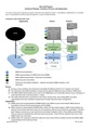
File:O&M 16jul 19 evolution of catchment planning.pdf (matches file content) identify common issues resulting in a draft Catchment plan (including actions + maps). (d) The draft catchment plan is presented at the Union Parishad level,(1,240 × 1,754 (587 KB)) - 16:20, 10 December 2020
File:E-1.1 CAWM Orientation Pat Khu 30-31 May & 4-5 Jun 2016.pdf (matches file content) opportunities; verification with WMG representatives 6. Using the location maps to indicate: existing cropping patterns, main water management bottlenecks(1,240 × 1,754 (1.18 MB)) - 11:49, 20 April 2021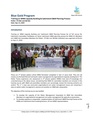
File:F-4.2 Training for O&M Sub com Patuakhali.pdf (matches file content) on 4 and 5th day The participants presented their group outcomes the WMGs maps, information of water management problems and solutions to potential crops(1,275 × 1,650 (485 KB)) - 19:12, 20 April 2021
File:C-9.1 Water and Land use Workshop P 55-2A.pdf (matches file content) output and observation Conclusion and Closing Some Raw Workshop Maps of 55/2A Digitized Maps of Polder 55/2A showing cropping pattern and water management(1,240 × 1,754 (2.78 MB)) - 05:50, 20 April 2021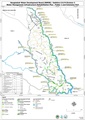
File:Infra rehab maps by polder 7apr 21.pdf (category Maps-polder) infra rehab by polder maps-polder(2,480 × 3,507 (9.52 MB)) - 04:52, 20 April 2021- Overview maps of the polders.11 members (0 subcategories, 11 files) - 09:58, 30 November 2021
- Polder maps from Blue Gold Program11 members (0 subcategories, 11 files) - 09:59, 30 November 2021

File:10jun 21 TerraSphere satellite mapping 2011 21.pdf (matches file content) 2011-2021 (3 maps for Khulna/Satkhira; 3 maps for Patuakhali) 5 maps for Perennial ghers: 2011, 2020 and change map 2011-2020 (3 maps for Khulna/Satkhira; 2(1,240 × 1,754 (909 KB)) - 07:01, 22 September 2021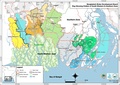
File:BWDB Circles, Divisions, BGP polders, Roads.pdf (category Maps-overview) BWDB Circles, Divisions, BGP polders, Roads maps-overview(2,481 × 1,754 (14.34 MB)) - 04:36, 20 April 2021
File:Satelligence final report 9jul 19.pdf (matches file content) kharif-I, kharif-II). Results are delivered as pixel maps and summarized statistics per polder. Maps are delivered per season for the baseline (20112015)(1,275 × 1,650 (5.2 MB)) - 10:12, 1 July 2020
File:O&M Guideline v5 5jan 18.pdf (matches file content) Bangla of the produced maps: Land Usage Maps (cropping pattern), Water Management Issue Maps and the Preferred Water Level Maps. All maps need to be digitalized(1,240 × 1,754 (6.6 MB)) - 16:24, 10 December 2020
File:BGIF03 IMARES WUR Quickscan Freswater Pearl Culture Feasibility 21jan 15.pdf (matches file content) study: gather as much information possible on Blue Gold polders in Patuakhali (maps, land use, environmental conditions), prepare questionnaires aimed at exploring(1,240 × 1,754 (569 KB)) - 10:58, 22 July 2020
File:E-3.6 CAWM Planning Workshop Khulna May 15-16 2019.pdf (matches file content) the collected data, identify the solutions, and prepared infrastructural maps and action plans. This process found more effective and cost-effective. 4(1,240 × 1,754 (613 KB)) - 18:51, 20 April 2021
File:E-3.1 CAWM Planning Workshop Pat 12-13 May 2018.pdf (matches file content) workshop, collecting data participants drew map and listed problems related to water management. Then prepared maps and problems were presented by the group(1,275 × 1,650 (516 KB)) - 18:19, 20 April 2021
File:BGIF08 Acacia - Feasibility study Aquifer Recharge for Agriculture 25feb 15.pdf (matches file content) Acacia Water Dhaka University 5 IWM has provided an altitude map of the Polder 22. This maps is shown in Figure 4. It shows that there is a difference in(1,240 × 1,754 (1.6 MB)) - 10:57, 22 July 2020
File:D-7 Training on Market Orientation for DAE FFS Facilitators.pdf (matches file content) process for performing the group activities. Each group made three value chain maps through their knowledge and understanding. After that, group leaders presented(1,240 × 1,753 (883 KB)) - 10:01, 20 April 2021
File:E-4.4 CAWM Robi Planning Workshop Pat+Khu Oct 22&29 2019.pdf (matches file content) Amulendu & Shusanta Presentation Amalendu Biswas Group work with help of maps Atik, Amulendu Presentation, Small Group Work Atik & Shusanta Presentation;(1,275 × 1,650 (830 KB)) - 18:56, 20 April 2021
File:G-3.1 UP workshop on Validation Catchment WM Plan Khulna.pdf (matches file content) has taken 3 to 4 hours of time. In this session WMG drown their own area maps in the brown paper, analyzed crops & water management relations, identified(1,275 × 1,650 (887 KB)) - 05:50, 21 April 2021
File:E-1.4 CAWM Orientation Satkhira 23-24 Jul July 2017.pdf (matches file content) Presentation, Discussion Experience Sharing Small Group Discussion, VIPP Maps; presentation; Field visit Small Group Work Review the day learning Day(1,240 × 1,754 (1.02 MB)) - 17:53, 20 April 2021
File:TR14 Phase 1 Baseline Survey Report.pdf (matches file content) Google Maps. In ODK Aggregate exporting the data into a KML file is as simple as a point and click. Using the GPS data, Google Earth or Google Maps will(1,240 × 1,754 (4.44 MB)) - 04:15, 10 March 2021
File:E-3.2 CAWM Planning Workshop Pat May 12-13 2019.pdf (matches file content) Group Exercise & Model Preparation Atik, Sydur & Amol - Demonstration of maps with possible best solution Review and identify best solutions CAWM implementation(1,240 × 1,754 (967 KB)) - 18:29, 20 April 2021
File:WP08A participatory monitoring red 28feb 17.pdf (matches file content) shown�in�polder�maps�using�different�colours:�level�0�=�red,�level�1�=�orange,�level�2�=�yellow,�and�level�3� =�green.�Thus,�four�theme�wise�maps�have�been�(1,239 × 1,754 (5.98 MB)) - 04:46, 28 July 2020
File:ARM Aide Memoire 2-14oct 2016 31oct 16.pdf (matches file content) available the required information (expected land acquisition projected on mouza maps). (Recommendation 1.7). The release of funds by the EKN should be synchronized(1,239 × 1,754 (4.25 MB)) - 10:54, 22 July 2020