Search results
From Blue Gold Program Wiki
- 29 Technical Assistance: Context, Scope, Contractual Arrangements and External Service Contracts (section Digital Elevation Models (DEMs))Contracts 3.1 Environmental Impact Assessments 3.2 Digital Elevation Models (DEMs) 3.3 Arrangements for Communications, Extension and Horizontal Learning 311 KB (1,065 words) - 11:26, 22 November 2021
File:BGIF11 Deltares - Water App tool for water management decision making in P43 2B Jan2017.pdf (matches file content) development. Activities Improving the DEM Polder 43/2B Limited survey work, DEM validation Improving the DEM for other Polders Prirotising (first polder(1,240 × 1,754 (5.39 MB)) - 10:57, 22 July 2020
File:BGIF12 MetaMeta - Roads for Water Management and Flood Protection Nov2017.pdf (matches file content) irrigation? Further analysis (DEM) needed Is this location appropriate in terms of water control for irrigation? Further analysis (DEM) needed 318 lat 22.1818416667(1,753 × 1,240 (24.68 MB)) - 10:57, 22 July 2020
File:BGIF01 IWM - Planning design and monitoring of community based WM systems in P30 .Jan2014.pdf (matches file content) and probable solutions. A map showing the selected WMUs, land elevation (DEM) and existing drainage systems is presented inFigure 1.This area currently(1,240 × 1,754 (5.15 MB)) - 10:58, 22 July 2020
File:BGIF02 Deltares - Feasibility pump drainage system BG Polders Dec2014.pdf (matches file content) and in fact already supplied a 50 x 50 m DEM (Digital Elevation Map) for Polders 2 and 31 (Figure 5). These DEM’s have already been used in this feasibility(1,275 × 1,650 (5.27 MB)) - 10:58, 22 July 2020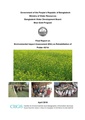
File:EIA P43 1A CEGIS Apr 16.pdf (matches file content) polder, an analysis using Digital Elevation Model (DEM) has been carried out. To establish the DEM, re-sampled 500m×500m grid levels (elevations) were(1,240 × 1,754 (12.93 MB)) - 10:49, 22 July 2020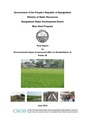
File:EIA P26 CEGIS Jun 16.pdf (matches file content) polder, an analysis using Digital Elevation Model (DEM) has been carried out. To establish the DEM, re-sampled 500m×500m grid levels (elevations) were(1,240 × 1,754 (51.83 MB)) - 09:54, 30 June 2020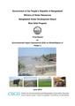
File:EIA P2 CEGIS Jun 16.pdf (matches file content) polder, an analysis using Digital Elevation Model (DEM) has been carried out. To establish the DEM, re-sampled 500m×500m grid levels (elevations) were(1,240 × 1,754 (9.51 MB)) - 10:53, 22 July 2020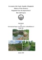
File:EIA P28-1 jan 20.pdf (matches file content) polder, an analysis using Digital Elevation Model (DEM) has been carried out. To establish the DEM, re-sampled 500m×500m grid levels (elevations) were(1,240 × 1,754 (8.95 MB)) - 20:15, 9 December 2020
File:EIA Report Polder 25 aug 20.pdf (matches file content) polder, an analysis using Digital Elevation Model (DEM) has been carried out. To establish the DEM, re-sampled 500m×500m grid levels (elevations) were(1,240 × 1,754 (10.03 MB)) - 20:23, 9 December 2020
File:DEM Khulna 2, 26 & 31part IWM (Jul 2015).pdf (category DEM) DEM & Delineation of Hydrological Boundaries for Polder-2, 26 & 31-part(1,240 × 1,754 (3.48 MB)) - 10:57, 1 July 2020
File:DEM-Khulna 22 CEGIS-(Nov-2016).pdf (category DEM) DEM and Delineation of Catchment boundaries for Polder 22(1,277 × 1,822 (1.41 MB)) - 09:00, 2 July 2020
File:DEM Patuakhali 55-2A-&-55-2C-CEGIS-(Nov-2015).pdf (category DEM) DEM and Delineation of Catchment boundaries for 2 Polders (55/2A & 55/2C)(1,275 × 1,650 (2.01 MB)) - 08:40, 2 July 2020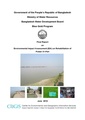
File:EIA P31 part CEGIS Jun 16.pdf (matches file content) polder, an analysis using Digital Elevation Model (DEM) has been carried out. To establish the DEM, re-sampled 500m×500m grid levels (elevations) were(1,240 × 1,754 (33.56 MB)) - 10:48, 22 July 2020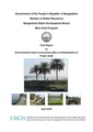
File:EIA P43 2E CEGIS Apr 16.pdf (matches file content) polder, an analysis using Digital Elevation Model (DEM) has been carried out. To establish the DEM, re-sampled 500m×500m grid levels (elevations) were(1,240 × 1,754 (9.99 MB)) - 10:49, 22 July 2020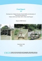
File:DEM-Patuakhali 43-1A-&-43-2F-CEGIS-(Nov-2016).pdf (category DEM) DEM and Delineation of Catchment boundaries for Polders (43/1A, 43/2F)(1,273 × 1,821 (3.63 MB)) - 08:57, 2 July 2020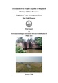
File:EIA P28-2 jan 20.pdf (matches file content) Digital Elevation Model (DEM) 28/2 Spot levels were interpolated into a continuous surface called Digital Elevation Model (DEM). DEM analysis infers that(1,240 × 1,754 (8.64 MB)) - 20:16, 9 December 2020
File:DEM Khulna 25, 27-1, 27-2, 28-1 & 28-2 CEGIS (Jan 2018).pdf (category DEM) DEM and Delineation of Catchment boundaries for Polder2 25, 27/1, 27/2, 28/1 and 28/2(1,250 × 1,767 (15.88 MB)) - 09:05, 2 July 2020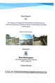
File:DEM-Khulna 29-&-30-CEGIS-(Jun-2017).pdf (category DEM) DEM-Khulna__29-&-30-CEGIS-(Jun-2017).pdf(1,250 × 1,889 (4.8 MB)) - 09:08, 2 July 2020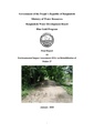
File:EIA P27 jan 20.pdf (matches file content) polder, an analysis using Digital Elevation Model (DEM) has been carried out. To establish the DEM, re-sampled 500m×500m grid levels (elevations) were(1,240 × 1,754 (8.04 MB)) - 20:12, 9 December 2020